• Images
  • Writing
  • Motion
  • About
Menu

Leyland Cecco

  • Images
  • Writing
  • Motion
  • About
×

The Fort McMurray Blaze Set the Stage for Even Bigger, Hotter Wildfires

Leyland Cecco May 21, 2016

As published by Take Part.

LAC LA BICHE, Alberta—“This was a monster,” says Joe Gauthier. “I’ve had big fires, but this was a monster.” Clad in the baseball cap and shirt he was able to grab when he evacuated his home in Fort McMurray on May 1, he sits in a fast-food restaurant in Lac La Biche, a small community southeast of the city struck by Canada’s third-largest environmental disaster on record. Hired in 1974 as the first firefighter in what was then a fledgling community, Gauthier rose to the rank of captain in the Fort McMurray Fire Department, which he served for 31 years. He saw the city grow into a boomtown over the past decade as oil companies set their sights on Alberta’s tar sands. As the raging fire overtook the city, he was forced to leave. “If it weren’t for these new knees,” says Gauthier, pointing down at the products of his recent surgery, “I’d have been out there fighting it myself.”

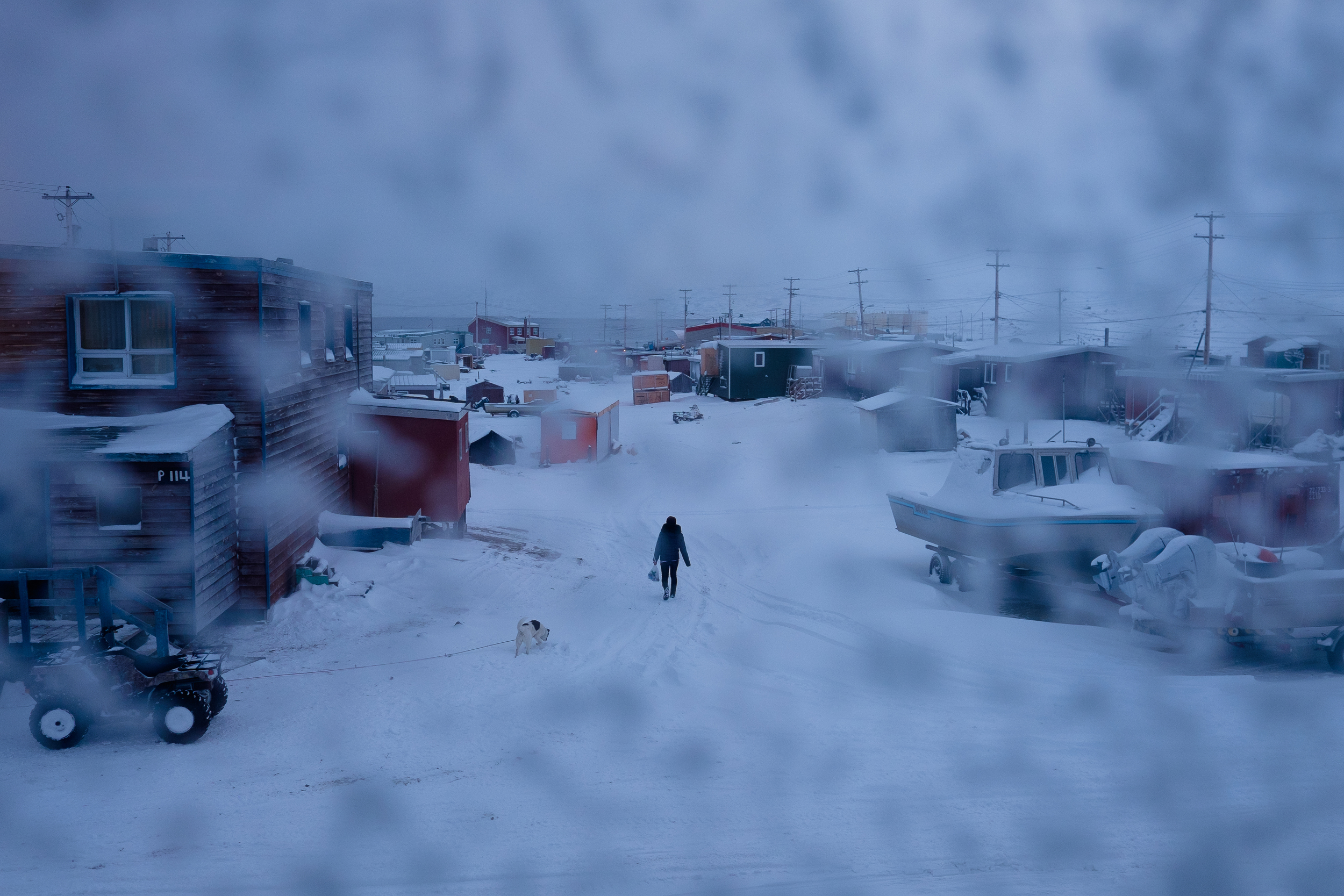
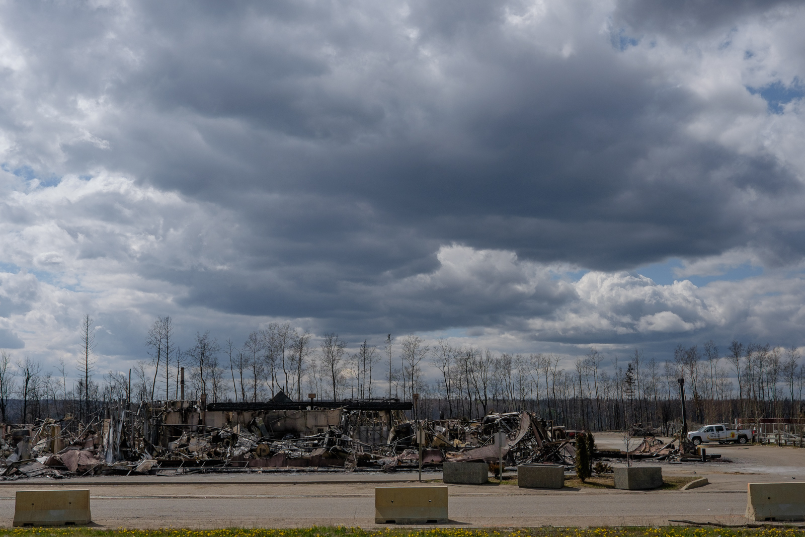
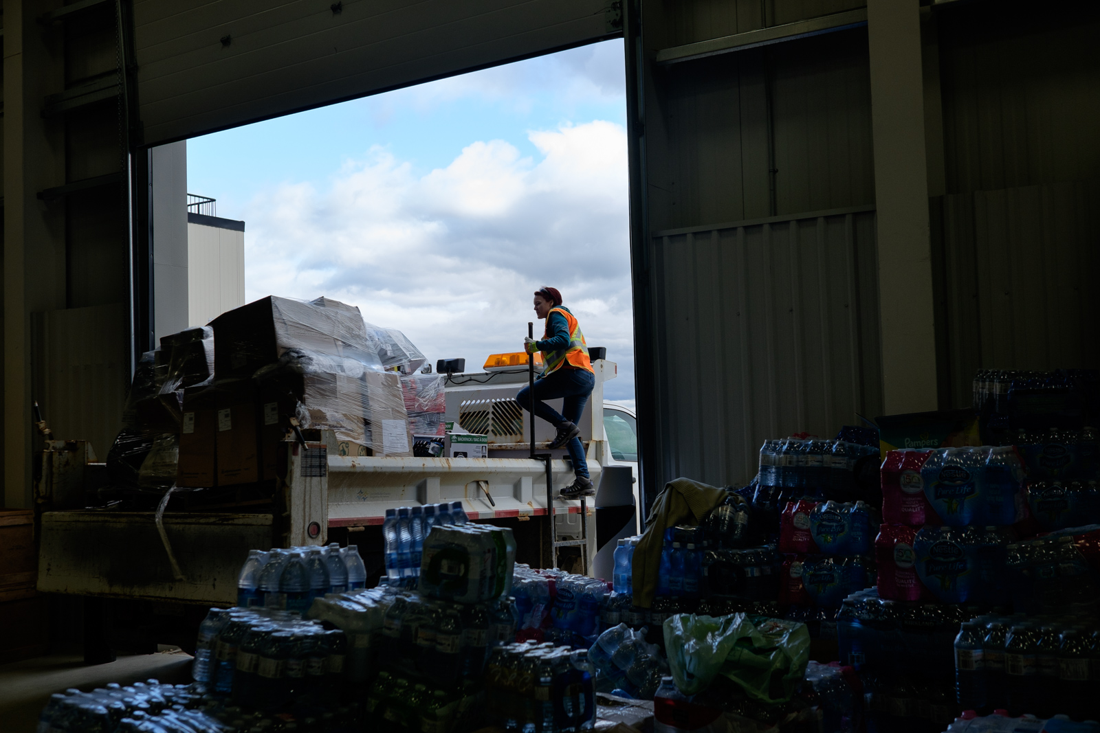
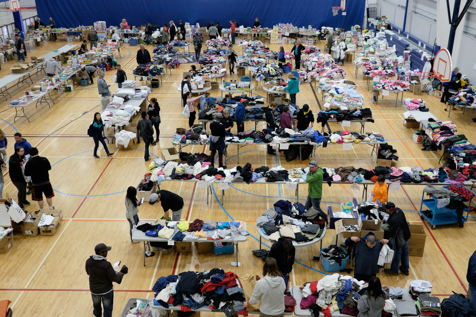
As is true south of the border, Canada’s wildfires are getting bigger, and the annual wildfire season is growing longer. In the past week, the blaze firefighters have nicknamed “the beast” has displaced more than 88,000, hit the country’s oil production, and grown steadily in size. Ignited by an unknown cause nine miles west of Fort McMurray, within a week it morphed into a 565,000-acre leviathan—20 percent larger than the city of Los Angeles—jumping highways and four rivers in the process and triggering a mandatory mass evacuation as crews met the flames in a series of pitched battles. The urban skirmishes couldn’t prevent the loss of more than 2,400 structures. The damage was a shock in an era of modern detection and suppression techniques. It approached the oil sands production areas, at one point reaching within 20 miles of a bitumen processing facility’s highly combustible chemicals. Estimates of the damage are higher than 9 billion Canadian dollars, on pace to be the costliest natural disaster in the country’s history. Though 90 percent of Fort McMurray was saved, its 61,000 residents are blanketed with uncertainty as officials block their return until the city is deemed safe.

A cocktail of heavy winds and dry weather pushed the blaze into residential areas, where at least some homes featured easily ignited wood-shingle roofs. Fire management policies and techniques—and luck—are also determinants of how big a fire becomes. And crucial parts of the forest are getting drier as temperatures are getting warmer. Mike Waddington, ecohydrology professor in the School of Geography and Earth Sciences at McMaster University in Hamilton, Ontario, likens the role of climate change in the beast’s size and speed to a baseball player who uses steroids: “On a particular home run, you couldn't say he hit that home run because of steroids. But he created the conditions that allowed him to hit more home runs.” Still, it may turn out that the most significant way climate and the beast were related was the opposite of what most people think: Climate change didn’t so much drive the fire as the fire (and future ones in the region) could drive climate change.  

Forests are designed to burn. It takes the heat of a fire to burst the dense, resin-covered, closed cones of jack and lodgepole pines, spreading seeds for new growth. Much of the province’s boreal forest serves as late spring and early summer kindling. Charred trunks and hungry flames are inextricably tied to forest health; a blaze works as a clearing mechanism for accumulated organic debris. As Alberta maintained a policy of total suppression of wildfires for decades, fuel built up, so that when fire did return—and every forest will eventually burn—it was hotter and bigger than it would have been had nature been allowed to take its course over the years. An especially intense igniter is the black spruce tree that thrives in Alberta. The highly combustible tree is a scourge to fire crews because if ignited, it can spray embers more than a mile. “For a while, black spruce was public enemy number one,” says Waddington.
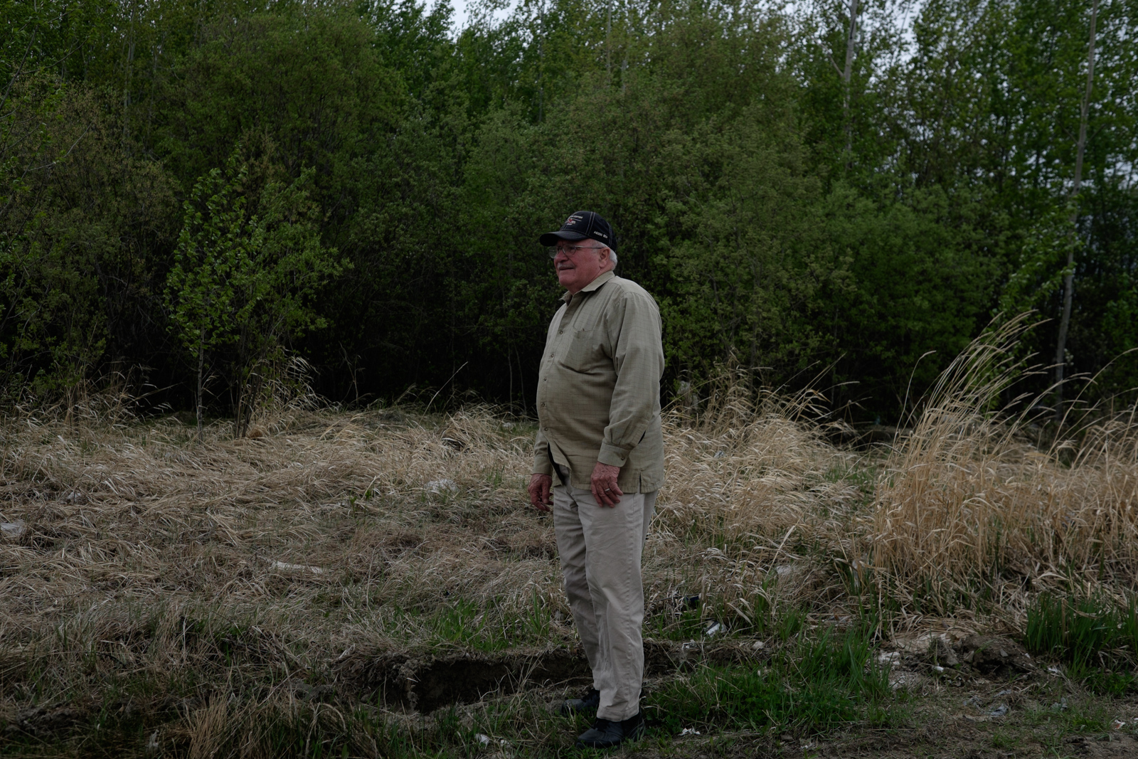
Joe Gauthier

Joe Gauthier

The Fort McMurray fire, like the devastating 2011 Slave Lake fire in Alberta, differs from blazes common in the province as recently as the turn of the century. A warm, dry winter and spring left little snow in the area, depriving the forest of moisture. Hot, windy weather dried out the trees and grasses of Alberta’s picturesque heartlands. Then, the weather formed what Gauthier calls the “crossover to perfection” when relative humidity, temperature, and air pressure all hit 30: 30 percent humidity, 30 degrees Celsius, 30 pounds of barometric pressure. In Fort McMurray, the magic numbers aligned on May 3 and 4. Within days, the fire became so large and intense that it created its own weather system, forming pyrocumulonimbus clouds, or clouds with lightning strikes, which set off additional fires. 

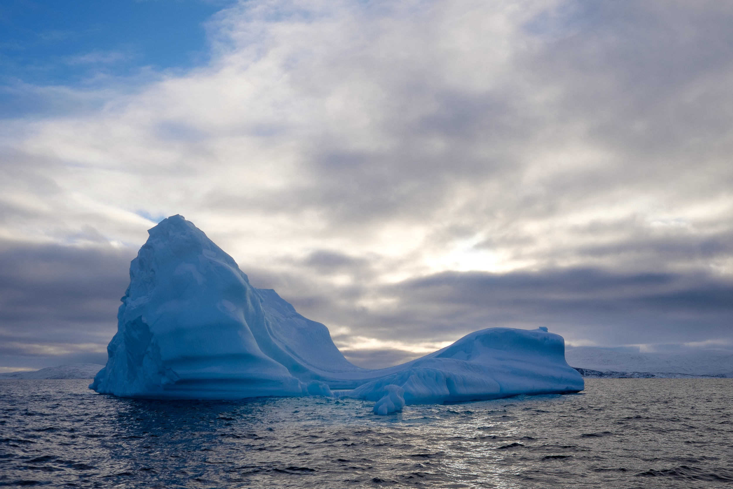
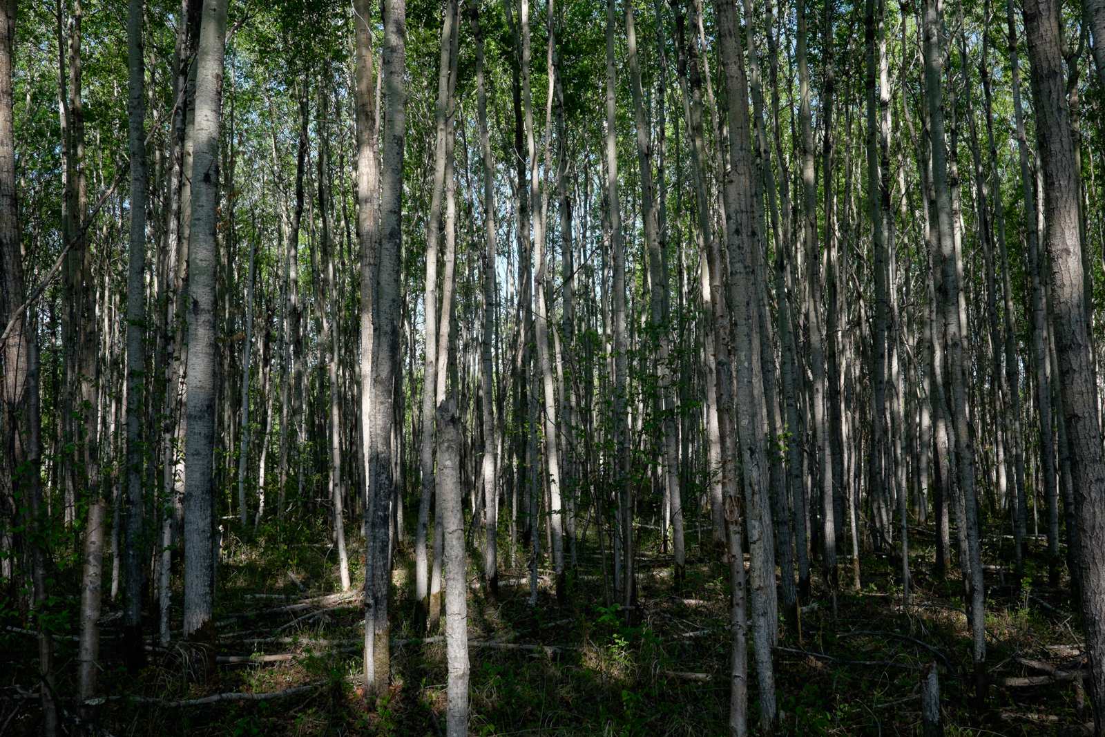
Peat is an important carbon sink in the boreal forest, holding thousands of years' worth of accumulated carbon. Drier weather—consistent with climate change models—makes the peat more susceptible to burning and releasing greenhouse gas. (Photo: Leyland Cecco)

In wildfire fighting, fire crews rely on natural and human-made barriers—rivers, highways, lakes, mountain ridges—to help temper an errant fire. Peat, or muskeg, a swampy ground cover, helps slow the spread of a blaze, starving it of fuel. In the northern sections of Alberta where the fire raged, the forests are pockmarked with bogs rife with organic matter—stored carbon. “Sixty percent of the boreal in the region is covered by peat,” says Waddington. Sphagnum, a natural fire retardant, grows plentifully in these bogs—with the right levels of moisture. But dry weather turned peat from a fire barrier to a global-warming catalyst. 

Peat fires are messy fires. They burn significantly longer, are harder to extinguish, and release significantly higher amounts of carbon dioxide and methane into the atmosphere. These greenhouse gases contribute to the climate conditions that ripened Alberta’s boreal forest for the beast, creating a positive feedback loop. The fires also burn deep. After a wildfire tore through Slave Lake, displacing the town’s 7,000 residents and destroying 374 structures, Waddington’s research team discovered the fire reached depths of five feet. When peat makes contact with a fire, it combusts at a temperature lower than flame but still smolders. Because the peat is porous, oxygen fuels the flame and carries it beneath the surface, where it becomes elusive. These deeper burns mean more legacy carbon accumulated over centuries is instantly released. Only a few days after the Fort McMurray fire started, crews suspected it had burrowed underground while it surged forward; ground cover with little moisture provided an easy entry point for the flames. Traveling undetected for miles and immune to the changing seasons above it, the flame reemerges far from the original fire. This becomes a threat: Fire crews digging perimeter lines have been caught by a flare-up from underground.

“It can take weeks to months, and certainly potentially over winter, for those smoldering fires to go out,” says Waddington.

In 1997, underground peat fires in Indonesia spewed tons of carbon dioxide and methane into the atmosphere, by some estimates making up nearly half of all global carbon emissions for the year. In 2010, massive fires spread throughout Russia’s peat, contributing to the deaths of 56,000 from poor air quality. Last year’s peat fires in Indonesia were the worst on record, torching an area the size of Massachusetts. Canadians need not worry about fires reaching these extremities: Both Russia and Indonesia drain their peat reserves to make room for agriculture, a practice that significantly increases the risk of long burns at the cost, in Indonesia especially, of extensive damage to wildlife habitat. Still, Canada has 30 times as much peat as Indonesia has; more than 680,000 square miles mix with the boreal topography. 

Experts fear things will only get worse. Two of Canada’s costliest fires, both in Alberta, have occurred over the last five years. Research by Uldis Silins, professor of forest hydrology at the University of Alberta in Edmonton, shows that over the past five decades, as suppression policy reigned, the total area burned in Alberta decreased. But when he and his colleagues looked at the sizes of the largest fires, they found that the past 15 years saw increasingly large blazes. “As burning conditions change, under extreme fire weather conditions, that’s when we go beyond our capability to suppress them,” he says.

Sometimes it takes a destructive fire to change policy. Before the Slave Lake fire, Maria Sharpe’s job didn’t exist. As wildfire management specialist at the Lac La Biche Fire Centre, a division of the provincial government, Sharpe develops preventive fire strategy. Her district and Fort McMurray are the only two in the province to have developed wildfire management plans; while Lac La Biche has executed its plan, Fort McMurray’s was still in the works when the beast hit.

With careful planning, forestry experts have ways to mitigate the power of megafires. Deliberate burning of forest, called a prescribed burn, and allowing natural fires to burn under close supervision are strategies that make sense from an ecological perspective. “Large tracts of mature forest just aren’t natural,” says Sharpe. 

But they can be a tough sell to the public. After 400 families in Los Alamos, New Mexico, lost their homes when a prescribed fire burned out of control in 2000, the public’s tolerance for the forest management strategy sank. Residents of a California town almost turned violent when officials told them that a naturally occurring fire threatening their homes had not been put out right away, so it could clean up accumulated fuels. And burned tracts accenting untouched forest lack the aesthetic appeal many want when they think of forests. Experts worry that if changes don’t come quickly enough, Canada will see more fires like Fort McMurray’s. 

While cooler temperatures and softer wind has slowed the fire’s progress this week, it will likely take months for it to go out. “At this point, only weather can kill it,” says Gauthier. The plan for the fire crews now is to guide it, using a nuanced mix of science and intuition, away from homes and other structures.

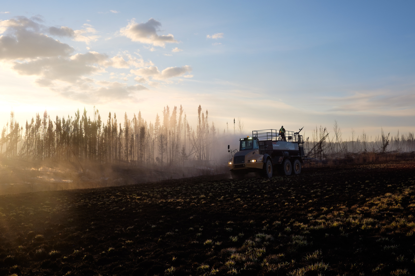
More than a week after the fire forced Gauthier’s evacuation, the peat continues to frustrate support crews. As the northern sun begins to set over a road 18 miles south of Fort McMurray at around 9:30 p.m. on May 11, acrid smoke drifts gently off the burned peat and hangs heavily in the air. Bulldozers are effective at turning over the peat to extinguish it, but the work is slowed by uprooted trunks, called jackpots by fire crews, littering the ground.

A crew from Fort McMurray relies on a repurposed HydroSeeder to spray down the smoldering peat. With each blast of water, fires pop up somewhere else in Whac-a-Mole fashion. The crew is tired of traversing the section of highway since early morning, and there is little to show for the day’s work. 

Comment

Opening the Canadian Arctic

Leyland Cecco December 17, 2015

As published by Al Jazeera America

IQALUIT, Canada — Flowing deeply between ice and rock, the waters of the high Canadian Arctic have been unforgiving for centuries to those who dreamed of a trade route that would bring goods more quickly from Asia to Europe. 

Expeditions to find the fabled Northwest Passage usually ended in failure, if not death. Perhaps the most infamous was the fourth attempt launched by British explorer John Franklin in 1845, whose crew was stranded for years, and, it’s rumored, succumbed to cannibalism

“The South has always been fascinated with the North and had a great imagination about it,’’ says Laakkuluk Williamson Bathory, an Inuk poet of Greenlandic and Canadian heritage.

This imagination somehow failed to account for the people who actually lived on the land, ice and water that separated the two continents.

“The middle part was seen as this inconvenient emptiness,” says Williamson Bathory.

While the thick sea ice blanketing the region for much of the year frustrated traders, it long served as a bridge for the Inuit, connecting them to neighboring communities and hunting locations inaccessible during warmer months.

Now, it is climate change that is unforgiving. 

Ice that was once present year-round is gone. Hunters say currents under ice floes are becoming increasingly unpredictable. Withering sea ice from an ever-warmer world is not only changing the landscape the Inuit relied on for their sustenance and culture. For the first time in history, the waning sea ice has opened up the Northwest Passage to commercial traffic.

Sea ice forms near the community of Clyde River.

Sea ice forms near the community of Clyde River.

While world leaders meet in Paris for the United Nations Climate Change conference and Prime Minister Justin Trudeau issues dire warnings about Canada’s Arctic, the country’s Inuit worry they will be sidestepped when it comes to administering, monitoring and protecting the passage.

“We have never been the people sitting at a table, we’ve never been accorded that role,” says Aaju Peter, an Inuit activist based in Iqaluit. “It is continuously a lack of understanding or lack of respect or a lack of seeing Inuit as equal partners or autonomous.” At present, the Inuit have no formalized way to flag environmental concerns. An agreement between the Inuit and the federal government to form a Marine Council through which the Inuit would advise the federal government has yet to be fully formed despite years of false starts

In the hamlet of Clyde River, 280 miles above the Arctic Circle, worries of an oil spill hang heavy over the region. Sheltered in a bay, the community is on the east coast of Baffin Island where ships pass by on their way into the passage. 

“An oil spill would mean our main food source would be contaminated and not suitable for consumption. It would mean our way of life would basically change forever,” says Niore Iqalukjuak, manager of the Clyde River Hunters and Trappers Organization. “Hunting is how everyone gets food for their families.” 

Within the community, like so many others in the north, more than half of the communal diet consists of fresh game. The animals hunted by the residents, like narwhal, cover large distances in their migrations. A spill would have lasting impacts on vulnerable marine populations.. 

Laakkuluk Williamson-Bathory

Laakkuluk Williamson-Bathory

Even with the sea ice melting earlier and freezing later, the route remains fraught with obstacles that can capsize a ship, The freezing of sea spray on the top of a ship, known as icing, has the tendency to make a vessel top heavy and capsize. Growlers — icebergs sitting low in the water and difficult to spot — are notorious for sinking ships. Rocks and rogue waves are also a hazard. 

Oil tankers like the Exxon Valdez often capture the public imagination and fear. But cargo ships, such as those who might use the Northwest Passage, pose a danger as well. In 2004, the MV Selendang Ayu was grounded in a storm off the coast of the Aleutian Islands. Carrying 132.6 million pounds of soybeans, the Malaysian-flagged ship broke in two, spilling more than 8,000 barrels of fuel oil. 

“The US Coast Guard didn't even attempt a recovery of the oil because they had no facilities or personnel,’’  says Michael Byers,a legal scholar and Arctic specialist at the University of British Columbia and author of “Who Owns the Arctic.’’

That was on the south coast of Alaska. It would be even more difficult further North. At present, there is no technology able to separate oil from sea ice. If a spill did occur, ocean currents would likely push the oil or contaminants under the ice, where it would be impossible to track or remove.

“We can't afford to have an oil spill in the Canadian Arctic,” Byers says. Prime Minister Justin Trudeau recently formalized a moratorium on crude oil tanker traffic along the north coast of British Columbia but to date he has remained silent on the environmental risks of ships passing through the Northwest Passage.

The last few years of weakening ice have opened up the passage for commercial shipping firsts in quick succession. In 2013, the Nordic Orion passed crossed the Northwest Passage assisted by an icebreaker.  It was an historical first for non-ice strengthened bulk carrier, travelling from Vancouver to Finland via the Arctic. Opting to bypass the Panama Canal, it shortened the journey by four days and 1,000 nautical miles. Only a year later and unassisted by an icebreaker, the MV Nunavik carried mineral ore from Quebec to China through the vaunted passage.

There is no shipping boom- yet. Last year, 14,000 ships passed through the Panama Canal,  producing $2 billion in revenue for the Panamanian government. Only 50 passed through the Northwest Passage. 

Yet as the summer ice melt extends further into the year, commercial shipping through the North   is becoming increasingly viable. “I'm certainly expecting that in the next 10-20 years, regular late summer, early fall shipping traffic will be considered normal in Canada's Arctic,” says Byers.

The mass melt-outs of sea ice beginning in 2007 reignited Canadian interest in the Northwest Passage and was a cornerstone of former Prime Minister Stephen Harper’s ‘Arctic Sovereignty’ campaign in 2007. This campaign aimed to reassert Canada’s legal claims to Arctic waters. The Canadian government argues the waters encircling its northern archipelagoes are internal, rebuffing American objections that they are in fact intentional waters.

A cargo ship waits to unload outside of Iqaluit. Without a deep water port, the offloading can take up to two weeks.

A cargo ship waits to unload outside of Iqaluit. Without a deep water port, the offloading can take up to two weeks.

To strengthentheir case for sovereignty, the Canadian government cites the perpetual use and inhabitation of the North by Inuit. 

Much of the waterway passes through Nunavut, an Inuit region of Canada, created by an historic land claims agreement between the Inuit and the federal government in 1993. Later granted territory status in 1999, Nunavut occupies 733,594 square miles- a fifth of Canada’s land mass. Through the Nunavut Land Claims Agreement (NLCA), the Inuit ceded all treaty rights granted under the Canadian Constitution in exchange for the right to hunt and trap the land and water as they had for thousands of year, as well as control over environmental stewardship of the land and waters.

Despite pinning their claims to the Arctic on the Inuit, the Canadian federal government has been largely absent in terms of development or community engagement. For years, Inuit communities have been promised deep water ports, infrastructure projects and money to combat the food and housing crises. The cost of running cargo planes is largely unaffordable so cargo ships travelling from Montreal to Iqaluit remain the lifeblood of the North, bringing in building supplies and food. Iqaluit, located on the southern edge of Baffin Island, is only accessible for short period in the summer when the Frobisher Bay is clear of ice. There are no operational deepwater harbors in Nunavut, so cargo has to be offloaded to barges, a process that takes weeks at a time.

Prime Minister Justin Trudeau (center) with Minister of Fisheries, Ocean and the Canadian Coast Guard Hunter Tootoo (left)

Prime Minister Justin Trudeau (center) with Minister of Fisheries, Ocean and the Canadian Coast Guard Hunter Tootoo (left)

Byers speaks to audiences around the world about the Northwest Passage and finds the only argument non-Canadians take seriously is Inuit use and occupancy. But he has yet to hear the same degree of responsiveness from successive Canadian governments, presumably because it would take billions of dollars to resolve the crises the Inuit face, money that has yet to appear.

“It would be widely regarded as hypocritical if they were invoking the Inuit to support Canadian sovereignty the same time they were letting them down,’’ Byers says.

 To date, none of the promises made to Nunavummiut have materialized. Prime Minister Trudeau has pledged to accelerate search and rescue capacity, alongside greater funding for Inuit-based programs to remedy what his Liberal Party sees as neglect over the last nine years.  

“The social, economic and health crises in Nunavut are worse now than they were 10 years ago,” says Byers. “You spend a small amount of money on housing, but nowhere near what was needed to address the problems.”

Even before the route opened to commercial traffic, the first clash between Inuit and the federal government arose in 2009. Amidst the headiness of Canada’s Arctic claims, a Conservative Member of Parliament introduced a motion to rename the Northwest Passage as the Canadian Northwest Passage. 

Autumn in Clyde River.

Autumn in Clyde River.

The move outraged residents in Nunavut. Paul Kaludjak, President of Nunavut Tunngavik Incorporated (the Inuit organization responsible for overseeing and implementing the NLCA) spoke before Parliament.

 “We are from Nunavut. Nunavut means “our land” and not anyone else's transit way,” he testified. “The term ‘Northwest Passage’ raises an immediate question: northwest of where and of what? The reference point seems to be London, England, and that, I think, is the mindset we are trying to get away from.” 

Today, current NTI President Cathy Towtongie is equally clear where the Inuit stand. “The first preamble of our agreement says Inuit hold sovereignty for Canada. It’s written right into the agreement.”

A focal point for Inuit concern is Lancaster Sound, the rich waters connecting Parry Channel with the Northwest Passage. For generations, the Inuit have called it Tallurutiup Tariunga for the rocks rising out of the water that resemble the traditional chin tattoos on Inuit women.

“It's really important to see the Arctic, specifically Lancaster Sound, as a dynamic place. The animals are travelling in and out of those waters, the waters are very kinetic, there's currents going in and out of there all the time. The people are going in and out of there, living there, travelling there,” says Williamson Bathory. Angering the communities in the area, Lancaster Sound is flagged for oil exploration. With the influx of commercial ships in record numbers, there are worries that this ecosystem could be irreparably changed.

In 2007, former Prime Minister Harper famously declared that in order to preserve the sovereignty of Lancaster Sound, Canada and the Inuit needed to ‘use it or lose it.’

“There was no thinking of our people having lived and died for thousands of years in the area,” says Lazarus Kalluk, an interpreter from Pond Inlet, a small community near Lancaster Sound. “Sometimes, they don’t see us as Canadians.”  

In addition to frustrations with government policy, Kalluk and others are worried about invasive species that could enter the area from shipping traffic. “We don’t know what could happen to the ecosystem if something new is introduced by accident on the hulls of these ships.” There already is legislation in place to prevent ballast water from ships from being dumped in certain regions, but Kalluk worries that might not be enforced. Byers supports this view, noting that with so little infrastructure and monitoring capabilities in the North, policing ship traffic and dumping is difficult. There is a constellation of unknowns for the communities given that international ships have never before moved through the Arctic en masse.

Sea ice, a mainstay of the North that inextricably binds Inuit to the environment, also looks increasingly vulnerable. Ships with reinforced hulls for icebreaking, or those with an icebreaker escort near hunting grounds rend the floes crucial for hunting. Hunters fear they will lose their ability to travel unfettered across the ice, a key mode of transportation for much of the year. Depending on how close ships choose to move to shore, ice breaking could damage the hunt. “There aren’t any shipping lanes established yet,” says Byers. 

Recently, when the Baffinland mining company with large interests in the area proposed shipping ore 10 months of the year from Pond Inlet on Baffin Island to Germany, it met sharp resistance.

“Ice is an essential part of life in the North. For people, for polar bears, for seals and other animals in the North, ice is a bridge — both metaphorically to the past and present Inuit values and activities, also actually as a fact,” wrote Chairman Hunter Tootoo of the Nunavut Planning Commission. “Ice physically links Inuit to their culture and values.” Tootoo now serves as the Minister of Fisheries, Ocean and Canadian Coast Guard for the Federal Government.

“Most these ships that are coming, the international voyages, will go straight through. They'll be on tight schedules. They're trying to save time and money and they're not going to stop en route,” says Byers. Revenue from shipping would likely be directed instead to the federal government. Despite shouldering most of the risk associated with commercial shipping through Arctic waters, the economic benefit to Inuit would be very little.

Instead, the Inuit feel they put up social and environmental capital to fund Canadian expansion of the Northwest Passage.

“I think that since explorers started showing up in the Arctic, it's always been this place for Southerners to test their mettle,” says Williamson Bathory. “And therefore, everything about the North is conquerable, including the environment, the animals and the people.”


Comment
← NewerOlder →